Start at Charing Cross Station
Finish at Charing Cross Station

THE EXPERIENCE
Eating and drinking adventures around the very centre of London
This route is in the centre of London and takes you on a circular tour around Charing Cross, which shows you the sights and the places to ‘Eat, Drink and be Merry’. These include the area around Trafalgar Square, which has theatres, galleries, fountains, monuments, and some hidden places to eat and drink. The area is rich in history and is a significant junction towards the City of London, Buckingham Palace, Covent Garden, the South Bank, Soho and Chinatown. The route around Charing Cross Station explores the central eating and drinking areas, with many more to the north of the Strand in Covent Garden, Leicester Square, Chinatown and Soho.
The route is excellent for history, iconic sights, museums, hotels, transport links, shops, art galleries, theatres, government buildings, narrow streets, and places to eat, drink and be merry.

BEST TIME
Morning- This route is not too busy, but it can get crowded around Charing Cross Station, Embankment Station and Trafalgar Square. The best time to explore the route is early morning when the lighting is at its best, and few people are around. It is also a great way to discover places for breakfast.
Day - This route will get busier along most of the route, especially around Charing Cross Station, Embankment Station, Villers Street, Whitehall and Trafalgar Square
Evening - This route will be fairly busy in the evening around Charing Cross Station, Embankment Station, and Villers Street,
ROUTE OVERVIEW
This 1.7 km route starts at Charing Cross Station and heads up towards St Martin’s Lane and across to the National Portrait Gallery. It then goes into Trafalgar Square, past the National Gallery and around Canada House to the start of Whitehall by King Charles Island – the official centre of London. The route heads up Great Scotland Yard and onto Northumberland Avenue before heading towards the river Thames by Embankment. It then swings under Embankment Place and up Villers Street before finishing up where it started at Charing Cross Station.

See the route at speed (1:54)
Use this to see what the route looks like as if you were doing it at speed, and to make you more familiar with what you will see along the way.
GOOGLE AND STRAVA MAPS
Use 'My Google Maps' to explore this route's venues. If you are using a mobile device, the map can help you find the start point for the route, navigate to places of interest, and show your position on the map.
What to see and places to eat, drink and be merry.
What to See List
The Centre of London - Pubs and Bars
The Centre of London - Places to Eat
The Centre of London - Things to Do
The Centre of London - Breakfast Venues
PHOTO GALLERY
This gallery provides a descriptive and visual reference to many sights along this route. Double-click to see the image in full size.
HISTORY & INTERESTING FACTS
Around Trafalgar Squaret
Around the Northern end of Whitehall
Around Northumberland Avenue
Around Villiers Street
VIRTUAL TOUR OF THE AREA
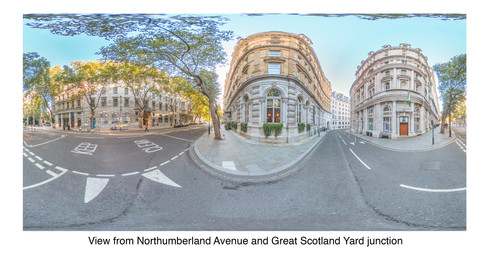
Click on the picture below to go on a 360 virtual tour of the shopping areas and look around.
Use the route to explore this location by looking around in 360, taking in the sights and sounds, listening to an audio recording about the area and going on a virtual tour.
Browse the gallery to find out what you can see along the way.


Comentarios